Start & Finish: Sommana, just outside Casertavecchia / Sat Nav: Parking & start of walk 41.098322, 14.380716 / Total distance: 6 km / Ascent: 260m / Highest Point: 620m / Typical Duration: 2 hours / Category: Moderate with a steep ascent
This walk offers the perfect mix for a great day out with family and friends. It has peaceful farm tracks, breathtaking hill-top vistas and the lure of coffee and homemade cake in Casertavecchia, one prettiest and most important medieval villages in Campania.


Background
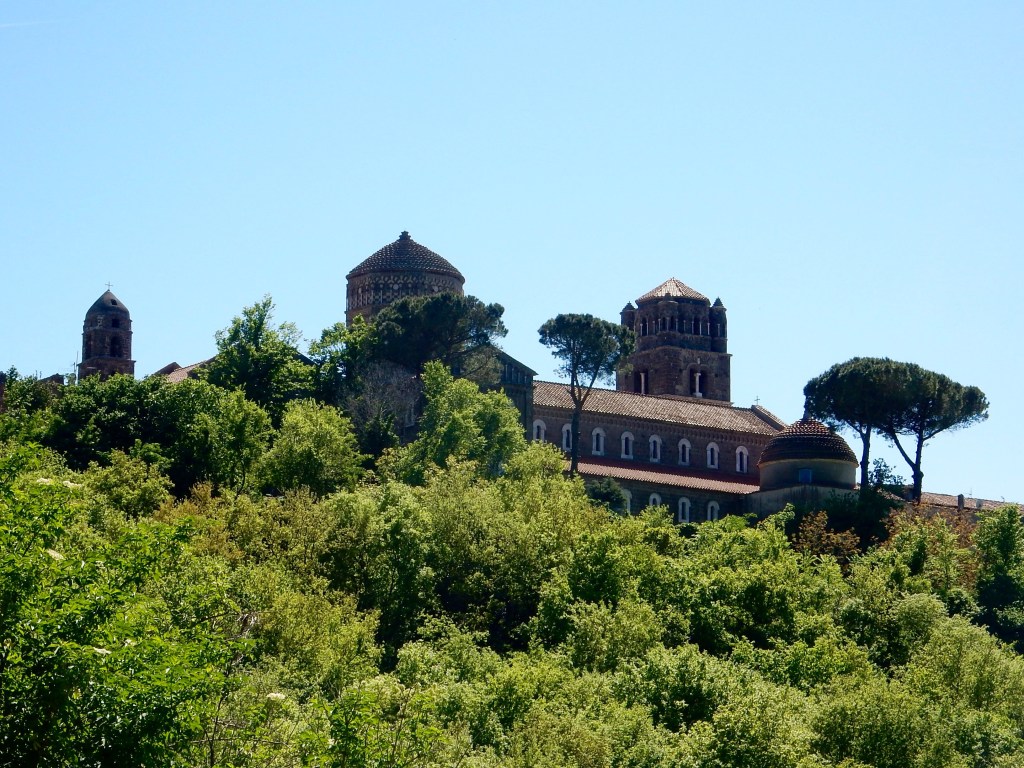
Casertavecchia has a unique atmosphere with ancient cobbled streets and impressive buildings that evoke the splendor of its past. The village originated in 861AD on a Roman site and was later conquered by the Lombards and Saracens, when it became highly fortified. In 1062 the Normans constructed the Torre dei Falchi (Tower of the Hawks) and in 1129 they completed the beautiful duomo (Cathedral of St Michael the Archangel). It sits in a square enclosed by the Bishop’s Palace, the Seminary and finally the Rectory which was completed in 1600. There is also a Gothic style church with a wonderful bell-tower where there’s always a throng of visitors looking up! For many decades Casertavecchia was an important religious and political centre for the region until the Bourbons built Caserta palace and it’s importance gradually declined. Today it is an Italian National Monument that’s popular with tourists. There are several restaurants where you can eat pizza outside while enjoying sublime views of Caserta and the plains, Vesuvius and the Gulf of Naples. Having said that, I almost always head for A Marchesina, a tiny pasticceria with great coffee and homemade treats piled in the window!
Map
Directions by Car
The walk starts in a hamlet called Sommana just outside Casertavecchia. Once you arrive at the intersection at the back of Casertavecchia (no cars are allowed in the village) take Via Tiglio, past a grass area with trees on your left and on a short way until the road widens slightly into a small, long square with trees along the left wall. Park here. Sat Nav:
Walk Description
If you are facing the wall with the trees take the lane at the right side of the square. You will know you it’s the right road as you will see a large white arch ahead of you. Go under the arch and continue up here as the road narrows. The buildings are very old and it’s quite atmospheric.
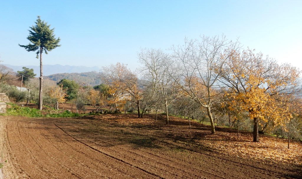
Turn right at the T-junction. The road looks a bit scruffy here but soon improves as it becomes a track. Follow this through leafy forest and beautiful farmland. On your right you’ll see peach, apple and cherry orchards, olive groves and market gardens. The slopes of Monte Virgo will rise up steeply beside you on your left. The track will slowly start to rise and become more rocky. Keep going and don’t take any other tracks that come off it. It’s hard to describe the next part but the track reaches a point where it flattens slightly at the crest of the hill with beautiful views ahead. You are looking for a faint path on your left through the forest. Ahead of you the track starts to go downhill and to your right there is another wide grassy track. Don’t go down or right! Look left for a sort of long grassy clearing going into a wood. At track level you’ll see a low slidey mud slope where mountain bikes go up. As a marker, on the right there is a little old orchard, broken picnic table and hut with a giant white gas tank. You are trying to go left opposite this.
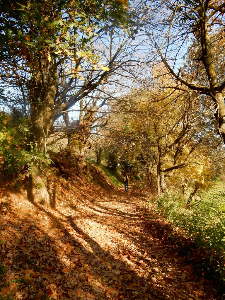
Follow the little path up into the forest. It gets steep and winds sharply. Do not deviate off this track – sometimes there are clearings and you seem to wind back on yourself. Eventually you come to a big stone wall that runs up the hillside. When we went there were cattle grazing and there was an electric fence on the wall. It’s on (battery further up) so crawl through carefully or pick up a stick further back to hold it up.
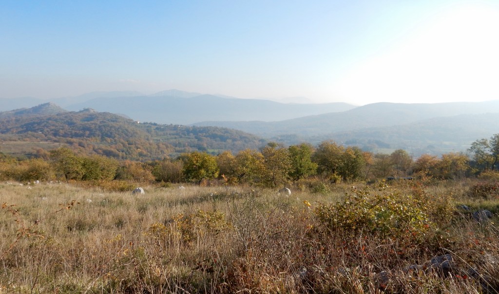
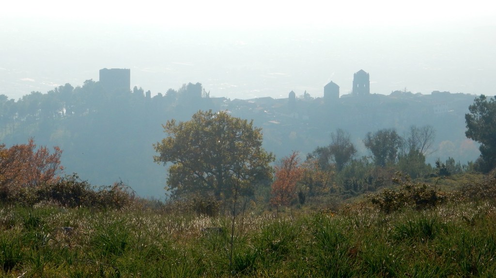
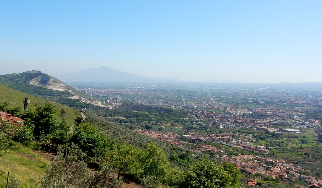
Keep the wall on your right and follow the well-worn track around the back of the hill. Here it rises very steeply to the top. Behind you are the hills near Caserta and in the Valle di Maddeloni and in the far distance the giant hulk of the Taburno range. To your right you’ll see the Matese Mountains (dusted in snow) and straight ahead the hills around Monte Maggiore. Your eye will be drawn to the castle on top of the hill at Castel Marrone just behind Monte Virgo. At the top you will reach an ugly solar/radio mast but the views are so wonderful you can ignore it! By now you can also look down on the remarkable towers of Casertavechia. We walked in the afternoon and they started to silhouette – it must be an amazing place to watch the sun go down. However, there is still a good 20-30mins back to the village so time it right!
From the top, follow a wide rocky track down with a fence on your right. You’ll reach some trees on your left and it then levels out a little. There’s low scrub on your right. You can carry on all along this ridge but don’t, follow the path bending sharply round to the left. It is wide and obvious. This goes down hill through pine forest all the way back to Via Lupara (the road into Casertavecchia). In one place there was string across the track to keep the cows in and a couple of shepherd dogs which were quiet (but be cautious if you have dogs).
Once you reach the road turn left and walk back to the intersection where you started. You can then go left on Via Tiglio back on the road to the car or go right and explore Casertavecchia. I have not eaten lunch there (there are a few touristy restaurants) but I can recommend little pasticceria ‘A Marchesina which serves the most delicious homemade cakes and tortes – a perfect pick-me-up after the walk.
Shorter options:
- You could just do the first section along the track from Sommana to the clearing at the top and then back to the car. It is ideal for kids with plenty of Autumn leaves, stones to turn, lots to see and talk about as well as being totally safe. If you look at the map you can extend this to make a little loop – so as you walk along the track look for a right coming in ‘Via Giuseppe Mirri’ – take this and it leads you back down to the main road where you turn right and walk back to the car.
- Alternatively, you could just park at the intersection (see car park) right outside Casertavecchia and do the main walk backwards. So take the track up from Via Lupara then zig zag up heading right and out to the mast at the top of Monte Virgo. It’s a long hill up but a good track and there are lovely views of Casertavecchia on the way. Early on the track you may need to go under some string to keep the cows in (if it’s still there).
When to go
Oct-May. Avoid the hot summer months. This walk is all about the views so choose a day with clear skies and low wind.
Walks Nearby
Castel Morrone & Grande Comola & Piccola Comola
Monte San Leucio – Tower
Monte San Leucio – Base
Local Attractions
San Leucio Palace & Silk Factory or here
Links
