Start and finish: Via Ortali, Castelforte / Start of walk & parking: 41.30651, 13.81773 / Distance: 5.8 km / Start elevation: 157m / Max elevation: 346m/ Gain: 207m / Typical duration: 1 hour / Category: Moderate
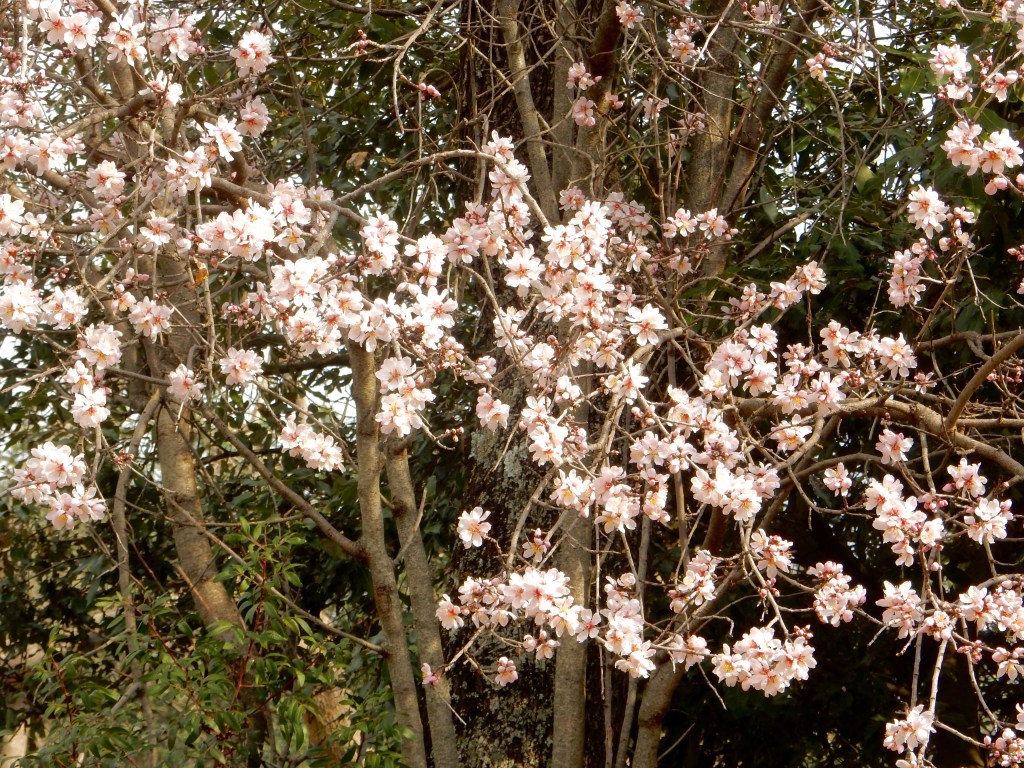
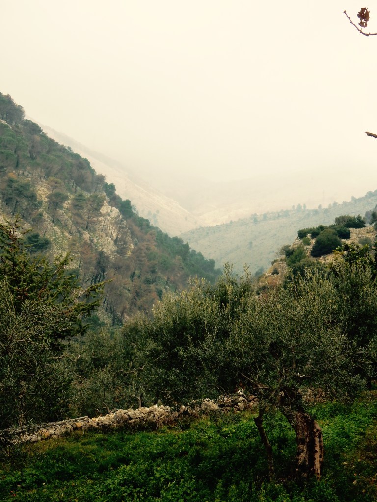
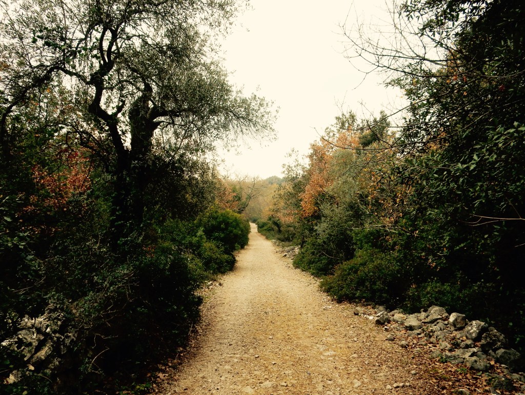
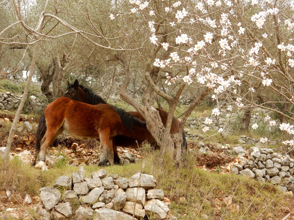
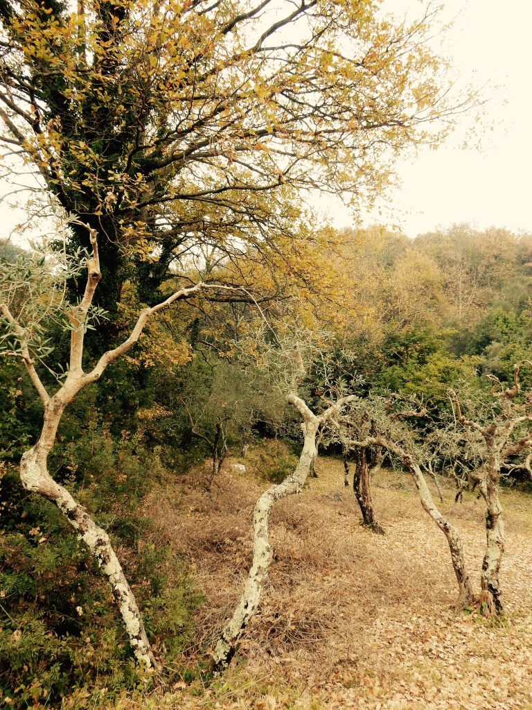
This pretty circular walk takes you around a lush valley covered with olive groves and mediterranean woodland in the foothills of the Aurunci mountains. It’s unlike anywhere else I’ve visited in Campania with it’s own unique microclimate; even in January there were cherry trees were in blossom. From the track there are stunning views of the sheer slopes of Monte Ceschito as well as glimpses of a spectacular karst rock valley rising up ahead – a taste of the beautiful hill walking nearby. You can also look back to see a silhouette of the old town and beyond to the plains and the sea which is very picturesque. While there are some steep uphill and downhill sections, it is all on paved road or good tracks which makes it ideal for children (including a sturdy pushchair) and anyone who prefers to keep on level footing.


Background
Nicknamed ‘little Cassino’ (after Monte Cassino), Castelforte is a fascinating town with a stella defensive history due to it’s location set high in the foothills above the Garigliano river plain on the Lazio-Campania border. The landscape is one of vineyards, citrus and olive groves interrupted only by medieval villages and little roads lined with dry-stone walls. In the Second World War, Castelforte was held by the Germans and almost completely obliterated by bombing from the Allied forces trying to break the ‘Gustav line’. The local people suffered greatly but were resolute and the town was awarded a Gold Medal for Civic Valour in 2002. There are extraordinary images of this period here and here. Thankfully some of the old town survived and the little streets are very interesting to visit with a maze of stairs and alleyways, wrought ironwork and tiny balconies from now empty homes. Features of the centro storico include the Palazzo Municipale, the Porto Cianca (Holy Gate) and the two towers – of the Chiesa di San Giovanni and the Ventosa tower which you see as you look back over the town on the walk. If you need some sustenance before or after your walk, try the town’s unique interpretation of Neapolitan pastries which are made of rice flour or the picciolatielli: knots of bread dough seasoned with clove and fried in extra virgin olive oil. This area is also known for it’s thermal springs located at Suio Terme, a few miles away.
Map
Directions By Car
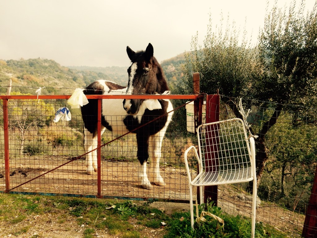
From Via Alfredo Fusco, look for a place where the road widens into a little triangle at the end of Via G.Aloia – this is point A where the blue line on the map starts. It’s a very narrow road that goes straight up through the old town – with a view of Monte Ceschito up ahead. There are little arches and alleyways inviting you to explore on all sides! Continue around a sharp left hand bend up to a T-junction. Go right on her on Via Risorgimento. Continue for a short way – the road will bend sharp left but go right off the bend and down a narrow lane: Via Ortali. Follow this down into a valley and back up around some sharp bends until you start to come out of the houses. Look for a field on the right (with a black and white pony) and some scrubby grass just ahead on the right. Park here. Up ahead you should see a fork – the left road looks like it goes up a hill to a house and the right carries on then bends to the right. The right hand road is the start of the walk.
The yellow marker on the map shows the main piazza in the old town if you’d like to explore it before or after you walk. This link has a walking tour and detailed map (in Italian but easy to work out the route from the building names).
Walk Description
From the parking area take the white concrete road heading right up the hill. You will pass a clearing with a little rubbish on the left hand side as you go round the first bend (the only mark on an otherwise pristine trail). Continue on this track winding up the hill for about 1 km until it levels out. The road is lined with dry stone walls, oak and cherry trees and there are olive groves on all sides with little farm sheds. Stay on this road for another 1 km and look for a wide sandy track on your right hand side. Go right here, slightly down hill and then on towards a long right hand bend. The track has high rocky sides at this point. Stay on this track as it undulates slowly down hill and through mediterranean forest. Do not take any other tracks you see until you reach a large T-junction with an ‘Attenzione’ sign. Go right here. The track starts to go downhill. After about 0.5 km you’ll see a road coming in from the left but go right around a big steep right hand bend and on down the track. This takes you past a big yellowy-orange house on the right before you reach a T-junction. Go right here. After a short way go straight over the next little cross road uphill to another T-junction. Go right here up the hill and round the bend back to the car.
When To Go
Great all year, avoid very hot days.
Children & Dogs
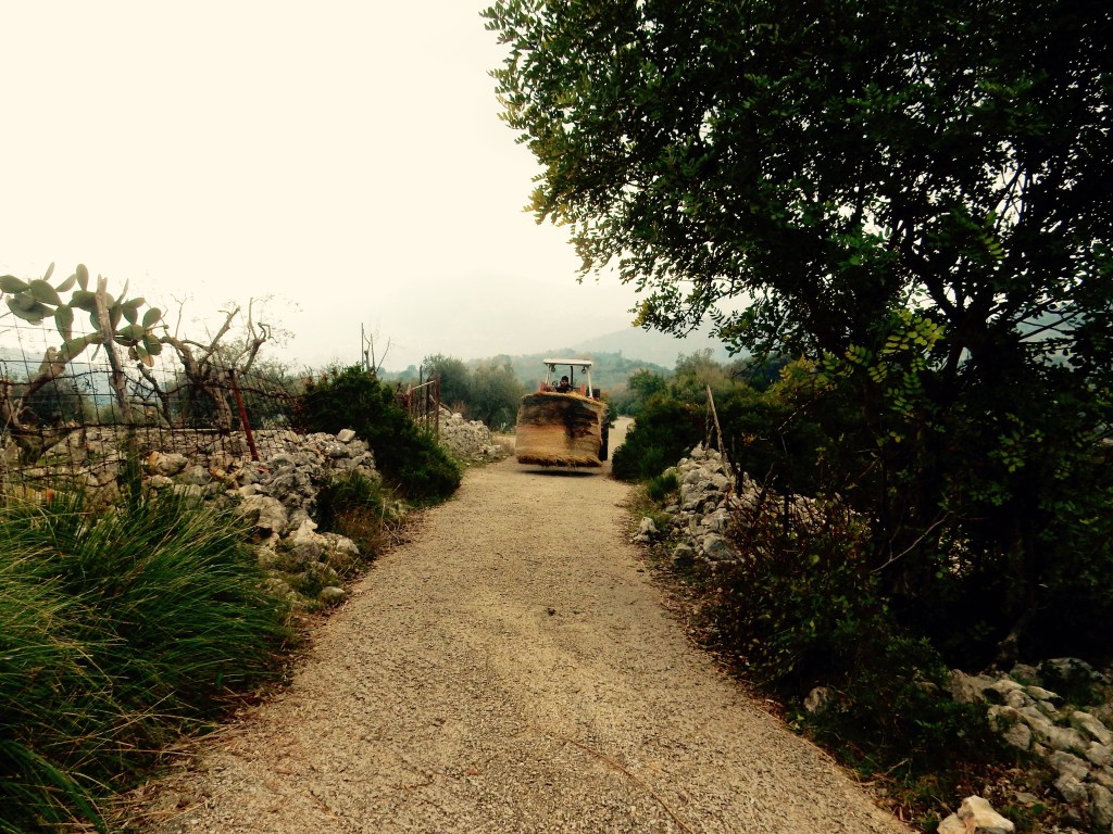
Perfect for children and dogs. It is a working farm track to several properties so there is the occasional farm vehicle and a few loose ponies around.
Amenities
None, take everything you need.
Walks Nearby
There are many more walks in these hills – details coming soon. Other walks in the region:
Baia Domitia Pine Forest & Dunes
Local attractions
Links
Castelforte Centro Storico brochure (in Italian)
